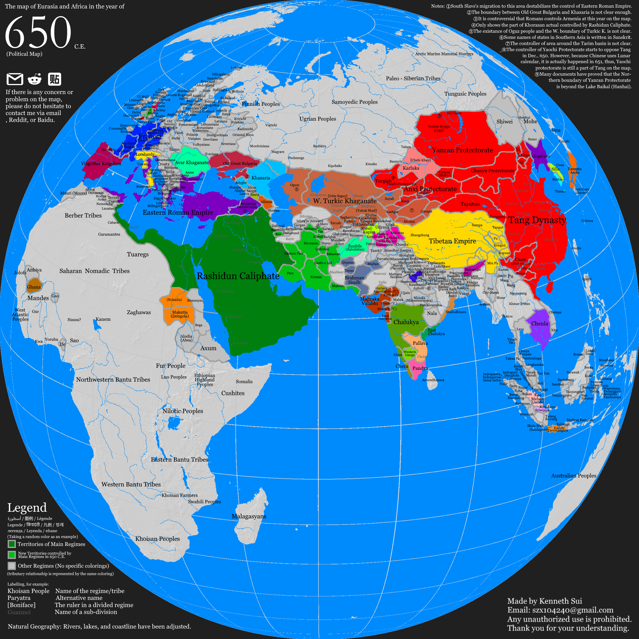
The Map of Eurasia and Africa in 650 C.E.
Properties: A Political Map depicting the Eurasia and Africa in 650 C.E.
Languages: English, Chinese
Format: Digital, 2500 * 2500 pixels, PNG
Purpose: Investigating the political landscape of Eurasia at that time
Tools: Paint.NET
English

Chinese
